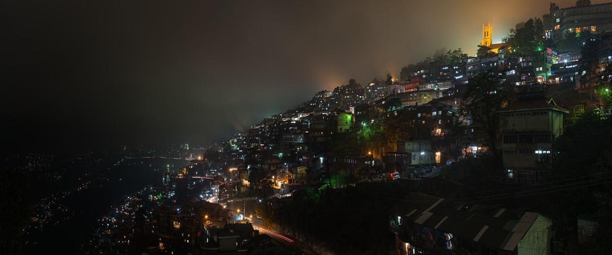
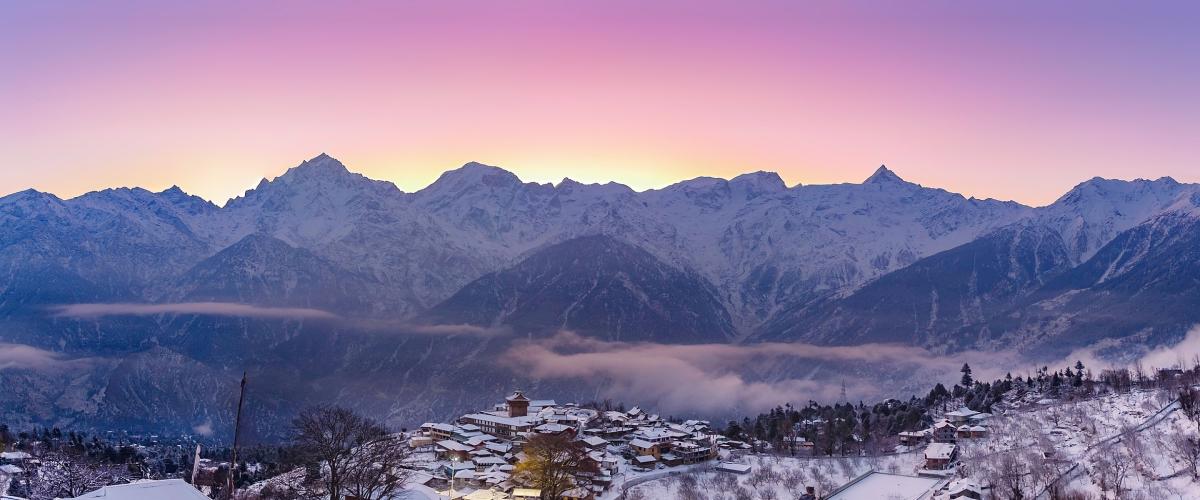
Shimla (also known as Simla, the official name until 1972. Shimla is the capital and the largest city of the northern Indian state of Himachal Pradesh. In 1864, Shimla was declared the summer capital of British India. After independence, the city became the capital of East Punjab and was later made the capital city of Himachal Pradesh. It is the principal commercial, cultural and educational centre of the state.
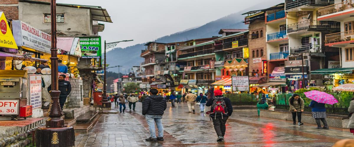
Manali is a town, near Kullu town in Kullu district in the Indian state of Himachal Pradesh.[2] It is situated in the northern end of the Kullu Valley, formed by the Beas River. The town is located in the Kullu district, approximately 270 kilometres (170 mi) north of the state capital of Shimla and 544 kilometres (338 mi) northeast of the national capital of New Delhi.
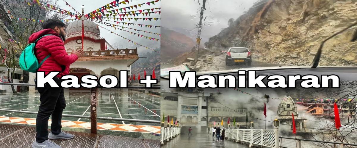
Kasol is a hamlet in the Kullu district of the Indian state of Himachal Pradesh. It is situated in Parvati Valley, on the banks of the Parvati River between Bhuntar and Manikaran. It is located 30 km (19 mi) from Bhuntar, 3.5 km from Manikaran and 36 km (22 mi) from Kullu town, the district headquarters. Kasol is the Himalayan hotspot for backpackers and acts as a base for nearby treks to Malana and Kheerganga. It is called Mini Israel of India due to a high percentage of Israeli tourists here.
Kasol is a hamlet in the Kullu district of the Indian state of Himachal Pradesh. It is situated in Parvati Valley, on the banks of the Parvati River between Bhuntar and Manikaran. It is located 30 km (19 mi) from Bhuntar, 3.5 km from Manikaran and 36 km (22 mi) from Kullu town, the district headquarters. Kasol is the Himalayan hotspot for backpackers and acts as a base for nearby treks to Malana and Kheerganga. It is called Mini Israel of India due to a high percentage of Israeli tourists here.
Dalhousie is a high-altitude town spread across 5 hills near the Dhauladhar mountain range in the north Indian state of Himachal Pradesh. It's home to colonial-era buildings, including St. Francis and St. John’s churches, which date back to the rule of the British Raj in the 1800s. A trek up Dainkund Peak leads to Pholani Devi Temple. To the north, Subhash Baoli is a peaceful area with pine trees and panoramic views.
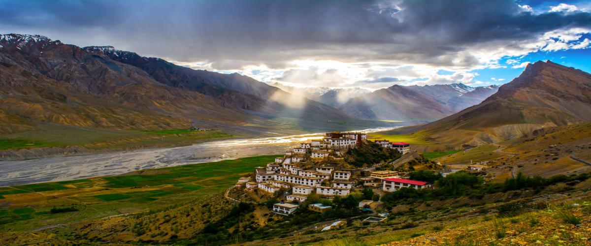
Spiti (pronounced as Piti in Bhoti language) is a high-altitude region of the Himalayas, located in the north-eastern part of the northern Indian state of Himachal Pradesh. The name "Spiti" means "The middle land", i.e. the land between Tibet and India. Spiti incorporates mainly the valley of the Spiti River, and the valleys of several rivers that feed into the Spiti River. Some of the prominent side-valleys in Spiti are the Pin valley and the Lingti valley. Spiti is bordered on the east by Tibet, on the north by Ladakh, on the west and southwest by Lahaul, on the south by Kullu, and on the southeast by Kinnaur. Spiti has a cold desert environment. The valley and its surrounding regions are among the least populated regions of India. The Bhoti-speaking local population follows Tibetan Buddhism. Traditionally, agriculture was for subsistence, but has shifted to cash crops in the past few decades. Spiti is a popular destination for photography, homestay tourism, and adventure tourism of various kinds, including winter sports.
Kinnaur district is one of the twelve administrative districts of the state of Himachal Pradesh in northern India.[1] The district is divided into three administrative areas (Kalpa, Nichar (Bhabanagar), and Pooh) and has six tehsils. The administrative headquarters of the district is at Reckong Peo. The revered Kinnaur Kailash mountain, one of the Panch Kailash sites, is situated in Kinnaur. As of 2011, it is the second least populous district of Himachal Pradesh (out of 12 districts), after Lahaul and Spiti. Around 235 km (146 mi) from the state capital, Shimla, Kinnaur is located in the northeast corner of Himachal Pradesh, bordering Tibet to the east. It has three high mountain ranges, namely Zanskar and the Himalayas, that enclose the valleys of Baspa, Satluj, and Spiti, as well as their tributaries. The slopes are covered with thick wood, orchards, fields and hamlets. At the peak of Kinnaur Kailash mountain is a natural rock Shivling (Shiva lingam). The district was opened to outsiders in 1989. The old Hindustan-Tibet Road passes through the Kinnaur valley along the bank of river Sutlej and finally enters Tibet at Shipki La pass. Kinnaur is the second richest district in terms of per capita income after Solan in Himachal Pradesh.
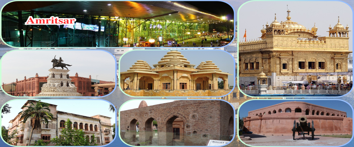
Amritsar, historically also known as Rāmdāspur and colloquially as Ambarsar. Amritsar is the second-largest city in the Indian state of Punjab, after Ludhiana. Located in the Majha region, it is a major cultural, transportation and economic centre. The city is the administrative headquarters of the Amritsar district. It is situated 217 km (135 mi) north-west of Chandigarh, and 455 km (283 mi) north-west of New Delhi. It is 28 km (17.4 mi) from the India-Pakistan border, and 47 km (29 mi) north-east of Lahore, Pakistan.
According to the 2011 census, the city had a population of 1,132,383. It is one of the ten municipal corporations in the state; Karamjit Singh Rintu is serving as the mayor of the city. According to the United Nations, as of 2018, Amritsar is the second-most populous city in Punjab and the most populous metropolitan region in the state, with a population of roughly 2 million. Amritsar is the centre of the Amritsar Metropolitan Region.
Amritsar is the economic capital of Punjab. It is a major tourist centre with nearly a hundred thousand daily visitors. The city has been chosen as one of the heritage cities for the Heritage City Development and Augmentation Yojana (HRIDAY) program of the Government of India. It is home of the Golden Temple, one of Sikhism religion's most spiritually significant and most-visited gurudwaras. The city is also known for Amritsari food, and wooden chessboards and the chess pieces manufacturing industry.
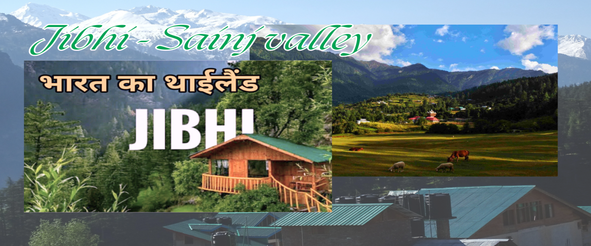
Jibhi and sainj Valley is renowned for its natural beauty and serene atmosphere. The village is surrounded by dense pine forests, pristine rivers, and captivating waterfalls, some lae or pounds. It is also known for its traditional wooden architecture and warm hospitality, offering visitors a glimpse into the rich cultural heritage of the region.